Amcotts
|
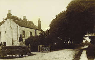
Formerly in the parish of Althorpe, it became a separate parish in 1850 and was in the manor of Crowle. Mentioned in the Doomsday Book as Amcotes, where the Lord had two carucates of land to be taxed, land to one plough, two sokemen and six villeins have one plough. The name appears to derive from the Anglo Saxon ’cote’ meaning simply a cottage or hut, and the personal name 'Am'. John de Amcotts was returned to parliament as member for Lincoln in the reign of Edward I (1307 — 1327), for several hundred years the village and immediate area belonged to the family of that name. The R. Trent probably altered its course near Amcotts in the early 18th C, when there seems to have been more than one channel. In 1836 between Hook Staithe and the site where the windmill stood, an old staithe was excavated and removed. It appears that this staithe and probably embankments had been built to alter the channels and reclaim the land for the estate as farm land, probably altering the course of the river to almost its present channel, the land gained was called Amcotts Pasture and was approximately 120 acres.
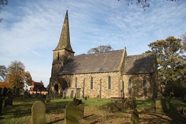
There was a chapel of ease in the village belonging to the church at Althorpe, this was a small thatched building which fell down in 1850 and was built on the site of a much earlier and larger church or chapel. St Marks Church was erected on the site in 1853 at a cost of £1300, the Wesleyan chapel was erected in 1870 and the school in 1860. Although Amcotts was in the manor of Crowle it seems to have been a smaller separate manor, having its own lord of the manor mentioned up to 1919. There was a ferry across to Flixborough but when it ceased is not clear we can only assume it was on the opening of Keadby Bridge in 1915/16. |
Click to link.


